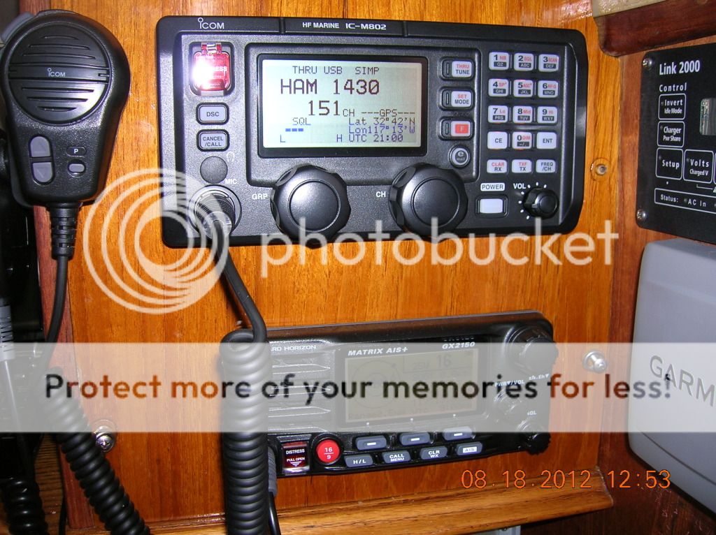
First we took the Garmin GPSMAP 740 Chart Plotter (NMEA 0183 network) port 2 white transmit wire that is mistakenly going to the Standard Horizon GX 2150 VHF radio and connected it to the coax cable (center strand) that goes to the BNC plug in the ICOM 802 SSB radio. The Standard Horizon GX 2150 VHF radio will send and receive from the Garmin chart plotter port 1 on the NMEA 0183 network (High speed).
The ICOM 802 SSB radio will receive form the Garmin chart plotter port 2 NMEA 0183 network (normal speed).
Then we took a green ground wire #16 and connected it to the
shielding on the coax cable and then to a common ground, in this case a ground
bus behind the nav station. Then Debbie cut the ground cable that was going to
the Standard Horizon Matrix GX2150 VHF
radio from the Garmin 740 NMEA 0183 network cable and connected the end from
the VHF radio to the common ground that the SSB is connected to. She did the
same for the Garmin NMEA 0183 network cable ground, connected it to the same
screw as the other two grounds. This was a lot more work that we thought it was going to be and it was very hot.

All wires are
connected correctly now as we think so lets test it out.
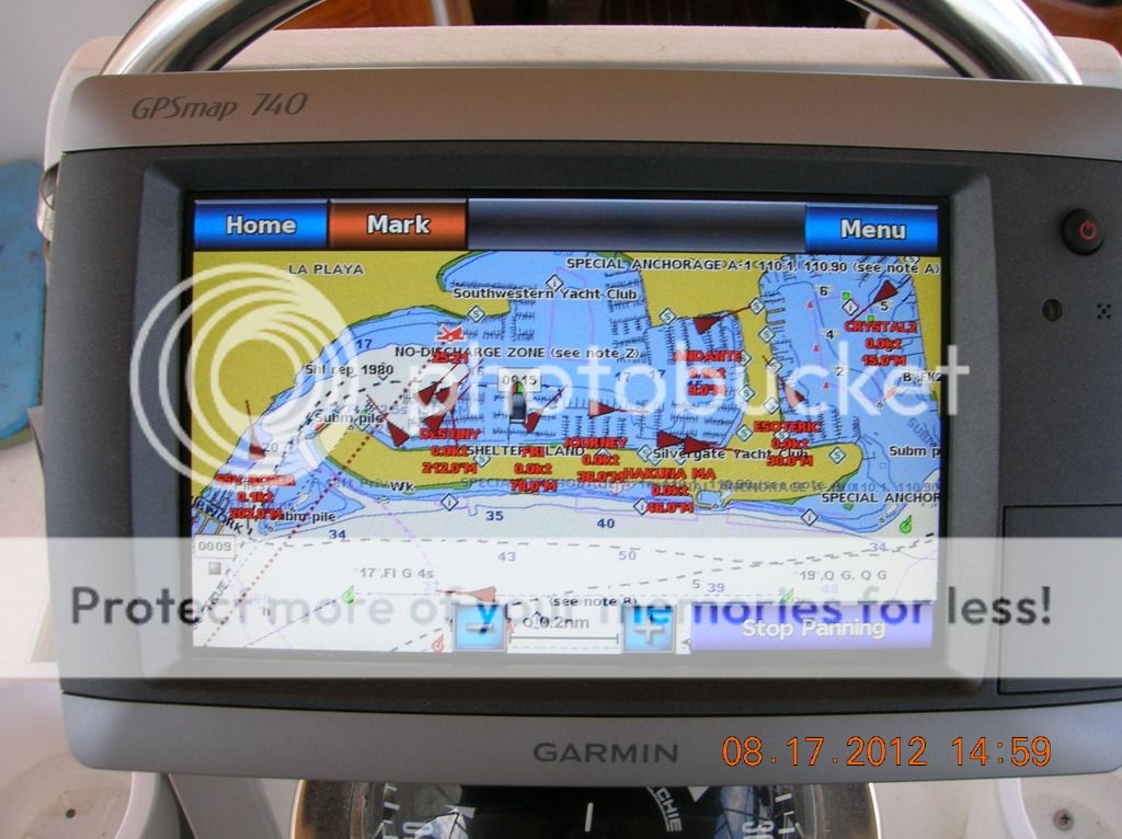
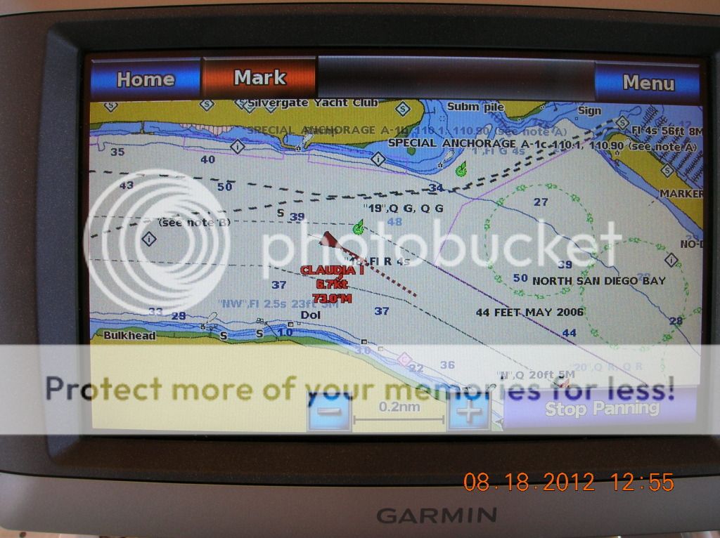
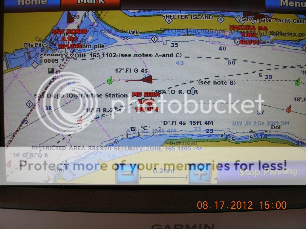
Some of the many AIS reporting boats in the area.
We fired up the Garmin GPSMAP 740 Chart Plotter and then the Standard Horizon Matrix GX2150 VHF radio.
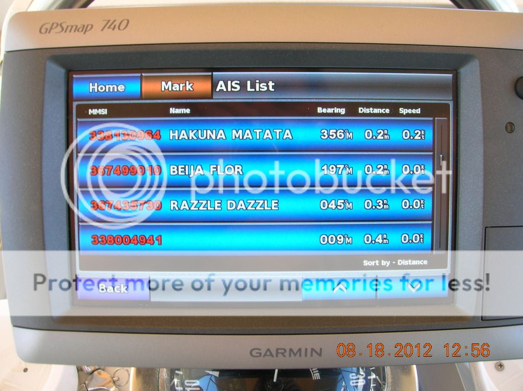
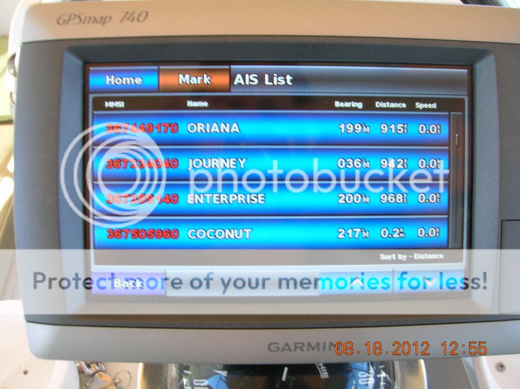
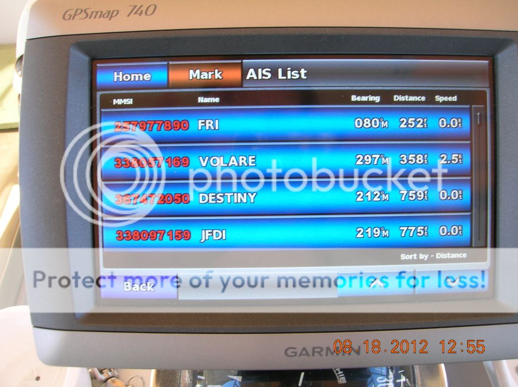
The list of AIS boats\ships is long. We were surprised to see all the boats at our marina alone that have AIS. We do not have AIS broadcasting. We can only receive.
The list of AIS boats\ships is long. We were surprised to see all the boats at our marina alone that have AIS. We do not have AIS broadcasting. We can only receive.

And the list goes on.

And on, so you get the idea.

Looking at our marina area.
This does make the chart plotter much more alive. You can
see a boat\ships progress as it goes down the channel and the speed and the plotter will move along with the AIS
vessel as it goes down the channel. It is very cool. How much we will ever use
it in Mexico is another story but it is the poor persons AIS as it came with
the price of the radio.
This could come in
handy in conjunction with the radar. If you are not sure of an object on the
radar you could see if it is identified on the chart plotter as a AIS vessel
etc.
Any way it make the chart plotter a lot more interesting and
fun to mess with.


Now for the ICOM 802 SSB radio and the GPS\time data.

As you can see the top radio (ICOM 802 SSB) is getting the gps data and time displayed on the screen.
This also means that if we press the emergency call button every one is automatically send our GPS location along with a distress call. very cool. The VHF radio does the same as it has the same GPS data sen to it but it has a very limited range.
Now to move on to the SailMail setup.
No comments:
Post a Comment