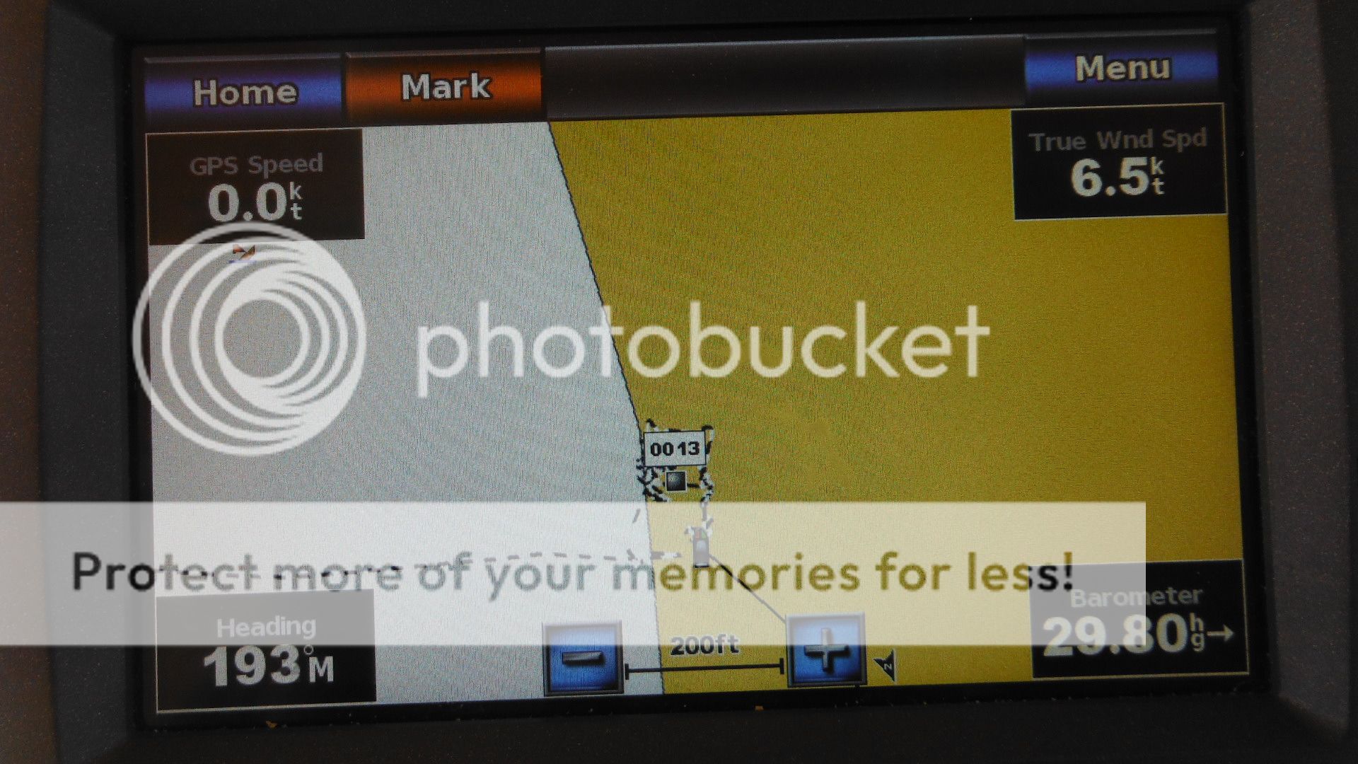
As you can see by the Garmin chart plotter we are anchored
on land not in Chamela Bay 😜 That is one reason why we use more than one means of navigation!

You can also NOT see any reefs which are shown in Charles’s charts.
We use four different nav aids.
Charlies Charts.
PacificMexico Guide - A Cruiser’s Guidebook.
Yachtsman – Mexico to Panama Chart Book (7th Edition)
Also some long distance full size charts for perspective – #501 and #502.
The Garmin chart plotter.
Now so far the Garmin chart plotter has been real accurate. At least on the big places like Mazatlán and Puerto Vallarta but in off-the-wall anchorages it is sad. It currently shows us anchored on land. Still, it is a good help.
Plotters of all brands share this problem in Mexico among other places, and it has to do with were they get their navigational information. Mexico has lagged behind the U.S. in updating their chart information because of money, but that has been changing in in recent years due to the Mexican Navy. As you've noted the large places are accurate but the small places are not, so someday in the future most places in Mexico will be accurate. Garmin and others get their charting information from a varity of sources, some are from guide books, private mapping companies, and from the Mexican Navy. Since Garmin only offers charting upgrades at a price maybe once a year, it will take a long time before Gamin charts are accurate everywhere in Mexico. The best thing to do in areas where chart information is not good on the Garmin, is to load your own reliable waypoints into the Gamin from your own observations and or guide books you trust and use them.
ReplyDeleteDid you get the watermaker fixed?
Don from FOGgers